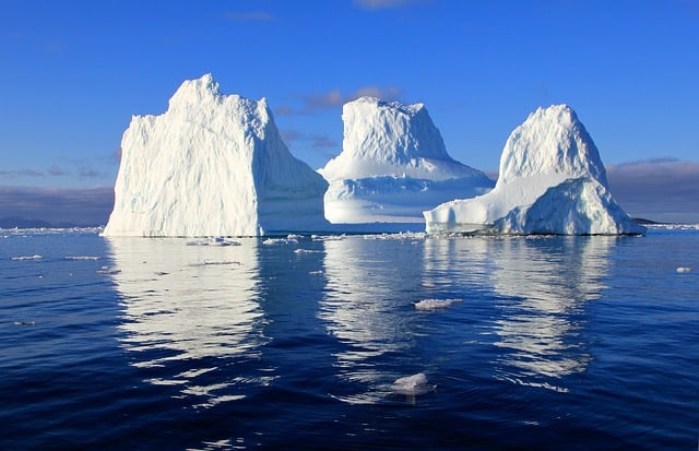
Greenland ice melt is seven times faster compared to its melting rate in the 1990s. An international team of polar scientists has given the assessment after reviewing all the satellite observations over 26 years.
Greenland’s contribution to sea-level rise is currently following a trend that had been labelled as a pessimistic projection of the future, scientists say.
Now Greenland could alone contribute to an additional 7cm of ocean rise by the end of the century.
This fact implies that many millions of more people in low-lying coastal regions would be at risk of flooding.
Currently, as per estimates, around a billion people live less than 10m above current high-tide lines, including 250 million below 1m.
“Storms, if they happen against a baseline of higher seas – they will break flood defences,” said Prof Andy Shepherd, of Leeds University.
“The simple formula is that around the planet, six million people are brought into a flooding situation for every centimetre of sea-level rise. So, when you hear about a centimetre rise, it does have impacts,” he told BBC News.
The British scientist Andy is the co-lead investigator for Imbie – the Ice Sheet Mass Balance Inter-comparison Exercise – a consortium of 89 polar experts drawn from 50 international organisations.
The reanalysis of the data from 11 satellite missions flown from 1992 to 2018, is done by the group. The repeat measurements of the changing thickness, flow, and gravity of the ice sheet have been taken by these spacecraft. The observations of the Imbie team has also been combined with the latest climate and weather models.
The outcome is that we get to witness the most comprehensive picture yet of Greenland’s reaction to the Arctic’s rapid warming. This part of the globe has seen a 0.75C temperature rise in the last decade.
Since the study period has begun, the Imbie assessment shows the loss of 3.8 trillion tonnes of ice from the island to the ocean, the mass of which is the equivalent of 10.6mm of sea-level rise. Moreover, the team also finds an acceleration in the data.
The rate of loss was equivalent to about 1mm per decade in the early 90s, currently running at roughly 7mm per decade.
Dr Ruth Mottram, a Imbie team-member, who is affiliated to the Danish Meteorological Institute said: “Greenland is losing ice in two main ways – one is by surface melting and that water runs off into the ocean; and the other is by the calving of icebergs and then melting where the ice is in contact with the ocean. The long-term contribution from these two processes is roughly half and half.”
At present, Greenland sheds about 250 billion tonnes of ice in an average year. However, this year has been exceptional for its warmth. In the coastal town of Ilulissat, near the location where the mighty Jakobshavn Glacier enters the ocean, temperatures recorded the high 20s Celsius. And temperatures got to about zero at its highest point in the ice sheet interior.
“The ice loss this year was more like 370 billion tonnes,” said Dr Mottram.
In 2013, a global sea-level rise of about 60cm by 2100 was projected by the Intergovernmental Panel on Climate Change (IPCC) – the authoritative body that reconciles all climate science. The ice melt and expansion of warming water considered.
But Imbie found the White Continent’s contribution by 2100 was likely being underestimated by 10cm when it published its companion review of Antarctica in 2018. Now, for Greenland, according to Imbie, the shortfall is 7cm. These updates need to be incorporated by the IPCC at the time of the release of its next major assessment report (AR6) of Earth’s climate in a couple of years.
Prof René Forsberg, from the Technical University of Denmark, mentioned that the importance of flying satellites, mainly those able to observe the top of Greenland, higher than 83 degrees north, underlined in the Imbie exercise. Only two of the present fleet can do so, out of which one is operating beyond its design life.
“Most of the changes we’ve seen in Greenland have been in the west, south and east; and now it has slowly moved up to the north. So, yes, the next satellite in the European Union’s Copernicus programme needs to go to higher latitudes, and this is being discussed by the EU and the European Space Agency,” Prof Forsberg told BBC News.
The new satellite system, which for the moment known as Cristal, but in case it flies, to be called a Sentinel, would be a radar altimeter to measure the changing shape of Greenland.
Imbie’s Greenland analysis is published in the journal Nature. Its release has been timed to co-occur with this year’s annual COP climate convention in Madrid along with the American Geophysical Union meeting in San Francisco. Leading earth scientists have gathered for these events.